
Gauxholme, near Todmorden. View east of road, rail and canal from above the A681 (928231).

Gauxholme, near Todmorden. View west from above the A681 (928231).

Gauxholme near Todmorden. View south from above the A681 (928231). Although most development is in the valley bottom the 'tops' also contain many scattered houses and farms.
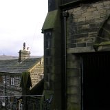
Cross Stone, near Todmorden. Church, now used for housing, and cottage, with Stoodley Pike in the distance.
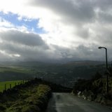
Cross Stone, near Todmorden. Looking south-west on the road down towards Todmorden.

Cross Stone, near Todmorden. Looking down onto Todmorden from the road into town. The curve of the railway is to the right of the Town Hall.

Stoodley Pike, as seen from above the railway tunnel (957247).

The lower end of the small clough that emerges near Rodwell End.

A small cascade near Charlestown (974266).

Heptonstall, as seen from the top of Mytholm Steeps. Some small patches of remaining snow are visible.

The road to Blackshaw Head. Looking into the valley from the top of Mytholm Steeps.

The road to Blackshaw Head. Stoodley Pike, as seen from the top of Mytholm Steeps.

The road to Blackshaw Head. A view towards Stoodley Pike and sheep.

Hippins Bridge. View to the north.

The stone path leading down into Dean Clough.

The upper footbridge in Dean Clough.
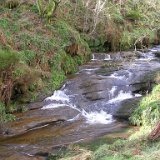
Dean Clough. The view north of the footbridge.

Dean Clough, looking south.

Dean Clough. Looking north towards the upper footbridge.

Dean Clough. Staups Mill from the north.

Dean Clough. Looking down on Staups Mill, with its fine masonry chimney stack.

Dean Clough. Inside Staups Mill, from the south. The far facade is mainly supported by the small stone upright to the right.

Dean Clough. East of Staups Mill the path rises high above the water.

Dean Clough. Looking down the path beyond the mill.

Dean Clough. Looking north from the bridge carrying the Pennine Bridleway. The culvert in the distance is reached by the path on the right-hand side.

Dean Clough. Looking south from the Pennine Bridleway bridge, with the track itself on the left.

Dean Clough. Looking south along the Pennine Bridleway.
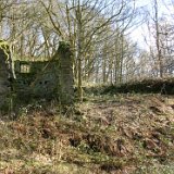
Dean Clough. Ruined buildings to the left of the Pennine Bridleway.

Dean Clough. Ruined structures and walls to the left of the Pennine Bridleway.

Dean Clough. Weir by the Pennine Bridleway. The river itself is constrained within impressive stone walls.
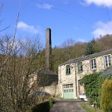
Dean Clough. The small mill near the southern end of the clough has a chimney of engineering brick, perhaps used in later years for a steam engine that replaced water power.
Walking east down from the moors towards Hardcastle Crags.

The road down towards Hardcastle Crags, approaching the National Trust boundary.

Gibson Mill. Restoration is in progress.

Gibson Mill. The east side the main building.

Looking north-west across Hebden Dale with Hebden Wood in the foreground.
Hebden Dale. The path above Hebden Wood.

Hebden Dale. Looking uphill at the trees by the path above Hebden Wood.

Looking down into Hebden Dale.

Looking east from the path descending into Hebden Dale.

Looking west along the path descending into Hebden Dale.

Rock with moss and plaque on the road running along the south side of Hebden Dale.

Looking down into Hebden Dale from the south side. The water in the distance is the lowest millpond in Hebden Dale.

Hebden Dale, south side. Pine trees hiding the sun.

Hebden Dale, south side. Woodland by the road.

This rarely-used path in Callis Wood leads to Cruttonstall (976264).
The path to Cruttonstall, now heading ENE. It construction indicates that it was once a much more important route.
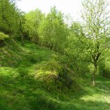
The path changes from its ENE direction on the right to south-west on the left.
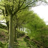
Looking uphill to the south-west along the path to Cruttonstall. The trees lining the left-hand side must have been planted.

Looking back downhill to the north-east along the path to Cruttonstall. Notice how well the path is constructed.
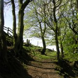
The stile at the top of the path, where a narrower path leads to Cruttonstall farm itself. The lane appears to have originally continued west beyond the stone post, although it's no longer a right of way.
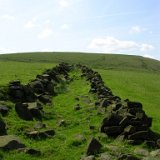
The path to Cruttonstall, looking south. The old walls have crumbled away and now clutter the route.

Sheep on guard. Looking south towards Cruttonstall.

Cruttonstall, within the ruin of the east end. Stones are balanced precariously on an old beam whilst an old barrow slowly disintegrates.

Cruttonstall. A blocked-up window on the south side of the farmhouse.
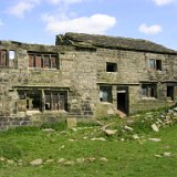
Cruttonstall, looking towards the southern front of the farmhouse. This building could be very old. Even the bricks used to block the windows look old.

Cruttonstall. A rusting farming implement on the path to the south-west.

Cruttonstall, the south front. A look back along the path going south-west.

Looking east to trees below Edge End Moor.
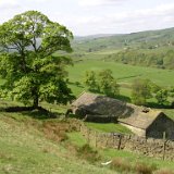
Thorps, seen from the path above.

Sun, cloud and vapour trail. Looking east towards Edge End Moor.
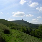
Stoodley Pike, as seen from the path above Lodge.

On the Pennine Way. The disused quarry above Doe Stones.


